Transform Infrastructure development with Advanced Drone Survey, monitoring and inspection.

Comprehensive Infrastructure Solutions

From construction to maintenance, we provide comprehensive aerial intelligence for infrastructure assets

Road & Highway Survey

High-precision LiDAR and drone surveys for road and highway planning, mapping, and corridor analysis.

  • High-density LiDAR point cloud generation
  • Accurate DTM and elevation models
  • Road corridor mapping and profiling
  • Cross-section and longitudinal profile extraction
  • Contour and terrain analysis
  • Design-ready survey outputs

Bridge Inspection

Detailed visual inspection of bridges and elevated structures without scaffolding or traffic disruption.

  • High-resolution visual mapping
  • Crack and corrosion detection
  • Structural deformation analysis
  • Condition assessment reports

Construction Progress Monitoring

Track construction progress with regular aerial surveys and detailed documentation for stakeholder updates.

  • Weekly progress reporting
  • 3D site digital twins
  • Volumetric stockpile analysis
  • Timeline compliance tracking
  • As-built vs. Design overlay
  • Safety compliance audits

Railway

Comprehensive inspection of railway tracks, bridges, and surrounding infrastructure for safety and maintenance.

  • High-density LiDAR point cloud generation
  • Accurate DTM and elevation models
  • Road corridor mapping and profiling
  • Cross-section and longitudinal profile extraction
  • Contour and terrain analysis
  • Design-ready survey outputs

Power Line Inspection

Safe and efficient inspection of transmission lines, towers, and substations without power interruption.

  • Tower structural integrity
  • Insulator condition checks
  • Thermal hotspot detection
  • Sag and sway analysis
  • Corridor vegetation mapping
  • Emergency storm damage assessment

Advanced Inspection Technology

Enterprise-grade equipment designed for critical infrastructure assessment

🚁

Industrial Drones

Heavy-lift drones equipped with stabilized gimbals for precise inspection work

📸

High-Res Cameras

Capture millimeter-level detail with professional-grade cameras and zoom lenses

📡

LiDAR Scanning

High-precision laser scanning to generate accurate 3D point clouds and structural models

🤖

Analysis

Defect detection for faster assessments

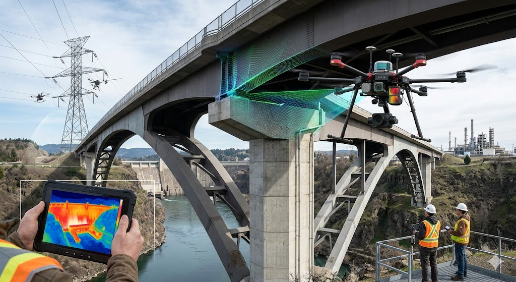
Why Choose Drone Inspections?

01

Enhanced Safety

Eliminate the need for workers to access dangerous heights or hazardous locations, significantly reducing risk.

02

Cost Efficiency

Reduce inspection costs by up to 20% - 30% compared to traditional methods requiring scaffolding or specialized equipment.

03

Minimal Disruption

Complete inspections without traffic closures, production stops, or service interruptions.

04

Comprehensive Data

Capture detailed visual documentation for asset management, insurance claims, and regulatory compliance.

Infrastructure Drone Inspection

Our Inspection Process

A systematic approach to infrastructure assessment and documentation

1

Site Assessment

We evaluate your infrastructure and develop a customized inspection plan based on your requirements.

2

Safe Deployment

Certified pilots execute flights following strict safety protocols and regulatory compliance.

3

Data Capture

High-resolution visual and thermal imagery is captured from multiple angles and perspectives.

4

Analysis

Our engineers review data to identify defects, anomalies, and maintenance requirements.

5

Detailed Reporting

Comprehensive reports with annotated imagery, recommendations, and prioritized action items.

Ready to Modernize Your Infrastructure Management?

Let our drone technology help you maintain safer, more efficient infrastructure assets