Pioneering the Future of Aerial Intelligence
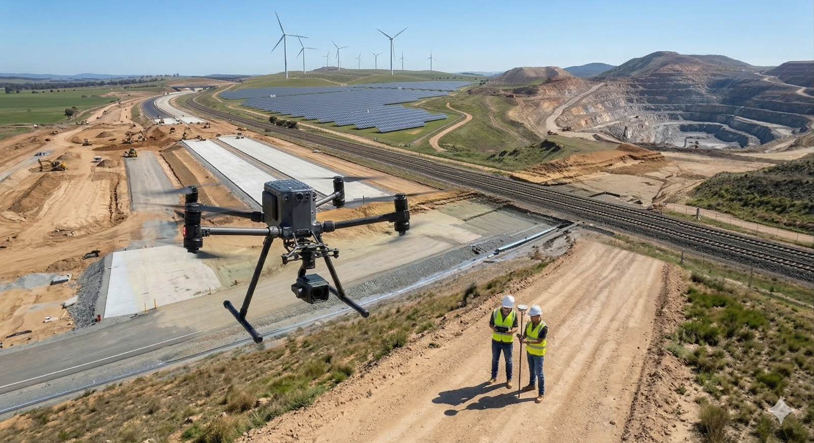
Sky2Earth Technology is a leading provider of drone and LiDAR-based surveying and mapping services, delivering high-accuracy and cost-effective geospatial solutions for both private and government sectors. We serve industries including land surveying, construction, renewable energy (solar and wind), mining, roads, and railways, helping clients improve planning, monitoring, and decision-making.
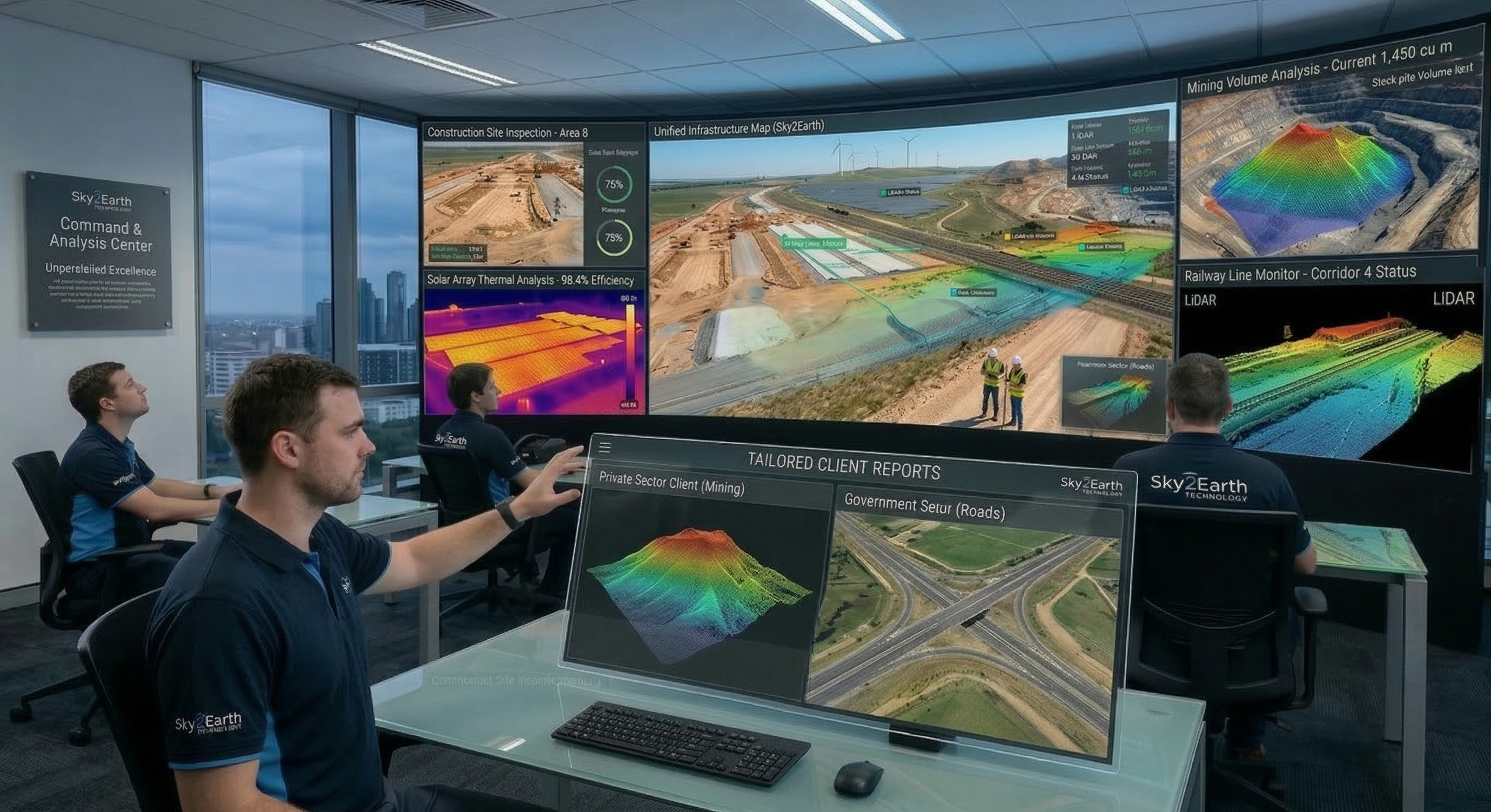
Our advanced cloud-based platform enables seamless data visualization and analysis, supporting topographical surveys, work-in-progress monitoring, and drone thermography. It empowers stakeholders with easy access to actionable insights, improving collaboration, transparency, and efficient project management.
At Sky2Earth Technology, our mission is to transform surveying and mapping through the integration of advanced drone and LiDAR technologies with intelligent cloud-based platforms. We strive to deliver highly accurate, real-time, and cost-efficient geospatial insights that empower clients to make faster, data-driven decisions.
By combining precision data capture with seamless cloud visualization and analytics, we enable smarter planning, efficient project monitoring, and optimized operations across industries.
The principles that guide everything we do
Delivering survey-grade results with unmatched accuracy in every project we undertake.
Continuously adopting cutting-edge technology to provide the most advanced solutions.
Operating with transparency and honesty in all our client relationships and partnerships.
Optimizing processes to deliver results faster without compromising on quality.
Providing specialized solutions across multiple sectors
Let's discuss how our drone technology can transform your project